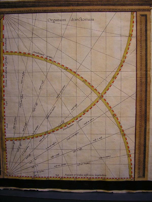
This diagram remained mysterious to Freek and me. Too bad, as it might have helped us decide how he made his map. Mercator kept that a trade secret--he was a smart businessman as well as a brilliant cartographer. The Prince gave him exclusive rights for 14 years to sell copies of his map--this copyright is printed prominently on the map itself. Some decades later, an Englishman discovered how to draw such maps and published his method, but later said that he regretted it and wished that, like Mercator, he had kept it secret. In Mercator's projection, circles of latitude become straight horizontal lines, and the trick is to adjust the vertical spacing of those lines so that "rhumb lines" (curves on the sphere that meet each line of longitude at the same angle) become straight lines in the projection. The vertical coordinates of the projected circles of latitude would now be calculated using logarithms, but perhaps Mercator just marked some rhumb lines on sphere and then adjusted his projected circles of latitude to make them come out straight. This diagram shows some projected rhumb lines he used for this purpose--the mystery is how he knew where to draw the lines of latitude. The Englishman Wright computed numerical tables of his vertical coordinates some years later--no trace of such tables by Mercator survives, but since Mercator was secretive about his methods, that doesn't prove they didn't exist. To me, it seems unlikely that Mercator used an actual sphere and actual rhumb lines on the sphere (as the Wikipedia article suggests); that would be too hard to machine and measure, and besides, how would you draw the rhumb lines accurately? Mercator must have had some way of calculating the lines shown in this mysterious diagram. |